Showing 411 results
Archival description
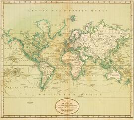
World. 1752 Robert de Vaugondy, Gilles, 1688-1766 Mappemonde ou description du globe terrestre dressee fur les memoires les plus nouveaux, et assujettie aux observations astronomiques, par le Sr. Robert de Vaugondy Fils. Paris, les Srs. Robert Geogs. ordes. du Roy, Quay de l'Horloge du Palais. Ante. Boudet Librairie-Impr. du Roy, rue St. Jacques, avec privilege
World. 1752 Robert de Vaugondy, Gilles, 1688-1766 Mappemonde ou description du globe terrestre dressee fur les memoires les plus nouveaux, et assujettie aux observations astronomiques, par le Sr. Robert de Vaugondy Fils. Paris, les Srs. Robert Geogs. ordes. du Roy, Quay de l'Horloge du Palais. Ante. Boudet Librairie-Impr. du Roy, rue St. Jacques, avec privilege
Woodville, Ontario: fire insurance plan / Chas. E. Goad Company
Woodville, Ontario: fire insurance plan / Chas. E. Goad Company
Winnett Boyd fonds
Winnett Boyd fonds
Windy Pine Point fonds. 1986 additions
Windy Pine Point fonds. 1986 additions
William Piercy fonds
William Piercy fonds
William Paterson fonds
William Paterson fonds
William Hamilton Munro fonds. 1980 additions
William Hamilton Munro fonds. 1980 additions
W.H. Munro's office copy of Bronson Co. property map in Ottawa (Chaudiere Area) with proposed parking lot, pedestrian bridge and adjacent government buildings. Scale about 126':1", sheet size 51 cm x 74 cm
W.H. Munro's office copy of Bronson Co. property map in Ottawa (Chaudiere Area) with proposed parking lot, pedestrian bridge and adjacent government buildings. Scale about 126':1", sheet size 51 cm x 74 cm
Warkworth Ontario: fire insurance plan / Charles E. Goad
Warkworth Ontario: fire insurance plan / Charles E. Goad
Victoria Road, Ontario: fire insurance plan / Charles E. Goad
Victoria Road, Ontario: fire insurance plan / Charles E. Goad
Vernon's Directory Map of Peterborough. Includes street index / published by Vernon's Directory
Vernon's Directory Map of Peterborough. Includes street index / published by Vernon's Directory
United States. Armed Forces. Northwest Service Command: Records of the Canol Project and Alaskan Highway fonds
United States. Armed Forces. Northwest Service Command: Records of the Canol Project and Alaskan Highway fonds
Unidentified Atlas of Canada - has large section on Victoria County including lists of settlers and current inhabitants; engraved views similar to Illustrated Historical Atlases, etc.
Unidentified Atlas of Canada - has large section on Victoria County including lists of settlers and current inhabitants; engraved views similar to Illustrated Historical Atlases, etc.
UK: printed material
UK: printed material
Two maps: reproduction titled "Great Lakes as mapped,"; and "Johnson's Upper Canada by Johnson and Ward
Two maps: reproduction titled "Great Lakes as mapped,"; and "Johnson's Upper Canada by Johnson and Ward
Trenton, Ontario: fire insurance plan / Underwriters' Survey Bureau
Trenton, Ontario: fire insurance plan / Underwriters' Survey Bureau
Trenton Ontario, topographical map
Trenton Ontario, topographical map
Trent Waterway, Canada. 1 inch: 6 miles, 71 cm x 122 cm, original, publisher: Department of Railways and Canals
Trent Waterway, Canada. 1 inch: 6 miles, 71 cm x 122 cm, original, publisher: Department of Railways and Canals
Trent Canal Ontario, marine map
Trent Canal Ontario, marine map
Trent Canal and Navigation Route: Collingwood to Belleville
Trent Canal and Navigation Route: Collingwood to Belleville
[Trench map], Field Survey Co.
[Trench map], Field Survey Co.
Tremaine's Map of the County of Durham, Upper Canada. Property owners identified on map, business directory on borders, businesses and residences illustrated on borders
Tremaine's Map of the County of Durham, Upper Canada. Property owners identified on map, business directory on borders, businesses and residences illustrated on borders
Travel maps and information (United States)
Travel maps and information (United States)
Township of Smith (showing hand-coloured route of the Peterborough-Chemong Railway. 1889-1899). 7000 feet: 4.5 cm, 76.5cm x 35.5cm, original
Township of Smith (showing hand-coloured route of the Peterborough-Chemong Railway. 1889-1899). 7000 feet: 4.5 cm, 76.5cm x 35.5cm, original
