Print preview Close
Showing 811 results
Archival description
Maritimes. 1846 Arrowsmith, John, 1790-1873 Lower Canada, New Brunswick, Nova Scotia, Prince Edwards Id., Newfoundland and a large portion of the United States. London, pubd. 15 Feby. 1846 by J.Arrowsmith, 10 Soho Square. Has inset map of Newfoundland. [Map no.] 42. From: The London Atlas of Universal Geography. Phillips, Maps, p. 197
Maritimes. 1846 Arrowsmith, John, 1790-1873 Lower Canada, New Brunswick, Nova Scotia, Prince Edwards Id., Newfoundland and a large portion of the United States. London, pubd. 15 Feby. 1846 by J.Arrowsmith, 10 Soho Square. Has inset map of Newfoundland. [Map no.] 42. From: The London Atlas of Universal Geography. Phillips, Maps, p. 197
Maritimes. 1851 Rapkin, J. Nova Scotia and Newfoundland. The illustrations by A. Russell & engraved by J. Rogers. The map drawn & engraved by J. Rapkin. London, J. Tallis, 1851. Coloured in outline. Coloured illustrations surrounding the map: Halifax, Nova Scotia and Cod fishing off Newfoundland. Has the seals of Nova Scotia and Cape Breton, and Newfoundland printed on the map. From: Tallis's Illustrated Atlas and Modern History of the World
Maritimes. 1851 Rapkin, J. Nova Scotia and Newfoundland. The illustrations by A. Russell & engraved by J. Rogers. The map drawn & engraved by J. Rapkin. London, J. Tallis, 1851. Coloured in outline. Coloured illustrations surrounding the map: Halifax, Nova Scotia and Cod fishing off Newfoundland. Has the seals of Nova Scotia and Cape Breton, and Newfoundland printed on the map. From: Tallis's Illustrated Atlas and Modern History of the World
Maritimes. 6 Nouvelle Ecosse et Nouveau Brunswick. Bruxelles, 1827. Phillips Atlases, 749. Vandermaelen, P.M.G. Amer. Sept. No. 44
Maritimes. 6 Nouvelle Ecosse et Nouveau Brunswick. Bruxelles, 1827. Phillips Atlases, 749. Vandermaelen, P.M.G. Amer. Sept. No. 44
Marjory Seeley-Rogers and Michael Treadwell recorded interviews
Marjory Seeley-Rogers and Michael Treadwell recorded interviews
Mark Robinson letter
Mark Robinson letter
Marketing your camp
Marketing your camp
Martha & Kenneth Kidd (Photo credit: Jack Marshall)
Martha & Kenneth Kidd (Photo credit: Jack Marshall)
Mary Jane Moncrief mathematics school book
Mary Jane Moncrief mathematics school book
Mary Tuer diary
Mary Tuer diary
Mary Tuer Diary and Letter Transcriptions
Masonic Hall installation banquet programme
Masonic Hall installation banquet programme
Maurice Boote (cont'd) and Jack Lodge (cont'd) recorded interview
Maurice Boote (cont'd) and Jack Lodge (cont'd) recorded interview
Maurice Boote recorded interview
Maurice Boote recorded interview
Meeting of the Delegates from the several Presbyterian
Meeting of the Delegates from the several Presbyterian
Memorial A.H. McDougall, Mary Ridleux, A. Fowlis, J. Carnegie, J.D. Collins
Memorial A.H. McDougall, Mary Ridleux, A. Fowlis, J. Carnegie, J.D. Collins
Michael Peterman recorded interview
Michael Peterman recorded interview
Millbrook baseball team and Millbrook band photographs
Millbrook baseball team and Millbrook band photographs
Miscellaneous legal documents collection
Miscellaneous legal documents collection
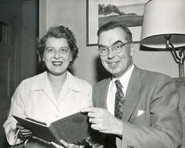
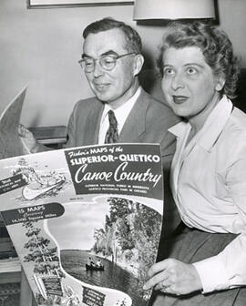
Missinaibi Lake Ontario, topographical map
Missinaibi Lake Ontario, topographical map
Montreal (Que.). 3 Bellin, Jacques Nicholas, 1703-1772. Carte de l'Isle de Montreal et de ses environs ... 1744. Paris, 1744. From: Charlevoix, Pierre Francois Xavier de, 1682-1761. Histoire et description generale de la Nouvelle France. Map no. ? See M. Bellin's introduction on maps in vol. III of Charlevoix
Montreal (Que.). 3 Bellin, Jacques Nicholas, 1703-1772. Carte de l'Isle de Montreal et de ses environs ... 1744. Paris, 1744. From: Charlevoix, Pierre Francois Xavier de, 1682-1761. Histoire et description generale de la Nouvelle France. Map no. ? See M. Bellin's introduction on maps in vol. III of Charlevoix
Montreal (Que.). Gastaldi, Giacomo, ca. 1500-ca. 1565 La Terra de Hochelaga nella Nova Francia. [Venice? 1556?]. Woodcut plan of the town of Hochelaga as described by Cartier who visited in 1535. One of earlier printed maps of Canada and the first one ever to use "Montreal" as a name, printed here as "Monte Real". Illustrations show the Indian village and stockade and the Indians meeting the French. Printed at top left corner: "446"; top right corner: "447". Taken from vol. 3 of Ramusio's Navigationi et Viaggi, Venice, 1556. [Ramusio, Giovanni Battista, 1485-1517]
Montreal (Que.). Gastaldi, Giacomo, ca. 1500-ca. 1565 La Terra de Hochelaga nella Nova Francia. [Venice? 1556?]. Woodcut plan of the town of Hochelaga as described by Cartier who visited in 1535. One of earlier printed maps of Canada and the first one ever to use "Montreal" as a name, printed here as "Monte Real". Illustrations show the Indian village and stockade and the Indians meeting the French. Printed at top left corner: "446"; top right corner: "447". Taken from vol. 3 of Ramusio's Navigationi et Viaggi, Venice, 1556. [Ramusio, Giovanni Battista, 1485-1517]
Montreal (Que.). Gastaldi, Giacomo, ca. 1500-ca. 1565 La Terra de Hochelage nella Nova Francia. Second ed. [Venice? 1565?] Woodcut plan of the town of Hochelaga as described by Cartier who visited in 1535. One of earlier printed maps of Canada and the first one ever to use "Montreal" as a name, printed here as "Monte Real". Illustrations show the Indigenous village and stockade and meeting the French. Printed at top left corner: "446"; top right corner: "447" Taken from vol. 3 of Ramusio's Navigationi et Viaggi, Venice, 1565. [Ramusio, Giovanni Battista, 1485-1517]
Montreal (Que.). Gastaldi, Giacomo, ca. 1500-ca. 1565 La Terra de Hochelage nella Nova Francia. Second ed. [Venice? 1565?] Woodcut plan of the town of Hochelaga as described by Cartier who visited in 1535. One of earlier printed maps of Canada and the first one ever to use "Montreal" as a name, printed here as "Monte Real". Illustrations show the Indigenous village and stockade and meeting the French. Printed at top left corner: "446"; top right corner: "447" Taken from vol. 3 of Ramusio's Navigationi et Viaggi, Venice, 1565. [Ramusio, Giovanni Battista, 1485-1517]
Montreal (Que.). Jefferys, Thomas, d. 1771 Plan of the town and fortifications of Montreal or Ville Marie in Canada. Published by Thos. Jefferys Geographer to His Royal Highness the Prince of Wales, at Charing Cross, Jan. 30, 1758
Montreal (Que.). Jefferys, Thomas, d. 1771 Plan of the town and fortifications of Montreal or Ville Marie in Canada. Published by Thos. Jefferys Geographer to His Royal Highness the Prince of Wales, at Charing Cross, Jan. 30, 1758
Montreal, Quebec: fire insurance plan / Underwriters' Survey Bureau
Montreal, Quebec: fire insurance plan / Underwriters' Survey Bureau