Print preview Close
Showing 138 results
Archival description
Rebellion Losses Bill, extracts of votes and proceedings
Rebellion Losses Bill, extracts of votes and proceedings
Red River, copy of all petitions addressed to her Majesty from 1860 to 1870
Red River, copy of all petitions addressed to her Majesty from 1860 to 1870
Re-union of the Provinces of Upper and Lower Canada, copies or extracts of correspondence, plus maps
Re-union of the Provinces of Upper and Lower Canada, copies or extracts of correspondence, plus maps
Robert Lloyd Hunter collection
Robert Lloyd Hunter collection
(Selected committee report), regarding legality of Hudson's Bay Company claim to Red River Territory, handwritten
(Selected committee report), regarding legality of Hudson's Bay Company claim to Red River Territory, handwritten
St. Lawrence River. 25 Jefferys, Thomas, d. 1771 An exact chart of the River St. Laurence from Fort Frontenac to the Island of Anticosti showing the soundings rocks, shoals, etc. with views of the lands and all necessary instructions for navigating that river to Quebec. London, Robert Sayer, May 25, 1775. Originally published: Lond, Thomas Jefferys at Charing Cross, Jan. 25, 1757. Phillips maps p. 762. Phillips Atlases 1165, map no. 9
St. Lawrence River. 25 Jefferys, Thomas, d. 1771 An exact chart of the River St. Laurence from Fort Frontenac to the Island of Anticosti showing the soundings rocks, shoals, etc. with views of the lands and all necessary instructions for navigating that river to Quebec. London, Robert Sayer, May 25, 1775. Originally published: Lond, Thomas Jefferys at Charing Cross, Jan. 25, 1757. Phillips maps p. 762. Phillips Atlases 1165, map no. 9
St. Lawrence, Gulf of. 15 Bellin, Jacques Nicolas, 1703-1772. Carte de Golphe de St. Laurent et pays voisins. Pour servir a l'Histoire generale des voyages. Paris, 1757. From: Charlevoix, Pierre Francois Xavier de, 1682-1761. Histoire et description generale de la Nouvelle France. Map no. ? See M. Bellin's introduction on maps in vol. III of Charlevoix
St. Lawrence, Gulf of. 15 Bellin, Jacques Nicolas, 1703-1772. Carte de Golphe de St. Laurent et pays voisins. Pour servir a l'Histoire generale des voyages. Paris, 1757. From: Charlevoix, Pierre Francois Xavier de, 1682-1761. Histoire et description generale de la Nouvelle France. Map no. ? See M. Bellin's introduction on maps in vol. III of Charlevoix
St. Lawrence, Gulf of. Bellin, Jacques Nicolas, 1703-1772. Carte du golphe de St. Laurent et pays voisins. Pour servir a l'Histoire generale des voyages. Paris, 1757? From: Charlevoix, Pierre Francois Xavier de, 1682-1761. Histoire et description generale de la Nouvelle France. Map no. ? See M. Bellin's introduction on maps in vol. III of Charlevoix
St. Lawrence, Gulf of. Bellin, Jacques Nicolas, 1703-1772. Carte du golphe de St. Laurent et pays voisins. Pour servir a l'Histoire generale des voyages. Paris, 1757? From: Charlevoix, Pierre Francois Xavier de, 1682-1761. Histoire et description generale de la Nouvelle France. Map no. ? See M. Bellin's introduction on maps in vol. III of Charlevoix
Stone, Joel. Holograph public notice signed by Stone, Leeds, announcing marriage of Peter Laver and Fanny Friekey
Stone, Joel. Holograph public notice signed by Stone, Leeds, announcing marriage of Peter Laver and Fanny Friekey
Textual records
Textual records
Upper Canada Rebellion, return of those arrested
Upper Canada Rebellion, return of those arrested
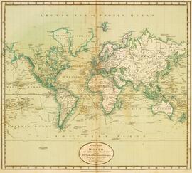
World. 1752 Robert de Vaugondy, Gilles, 1688-1766 Mappemonde ou description du globe terrestre dressee fur les memoires les plus nouveaux, et assujettie aux observations astronomiques, par le Sr. Robert de Vaugondy Fils. Paris, les Srs. Robert Geogs. ordes. du Roy, Quay de l'Horloge du Palais. Ante. Boudet Librairie-Impr. du Roy, rue St. Jacques, avec privilege
World. 1752 Robert de Vaugondy, Gilles, 1688-1766 Mappemonde ou description du globe terrestre dressee fur les memoires les plus nouveaux, et assujettie aux observations astronomiques, par le Sr. Robert de Vaugondy Fils. Paris, les Srs. Robert Geogs. ordes. du Roy, Quay de l'Horloge du Palais. Ante. Boudet Librairie-Impr. du Roy, rue St. Jacques, avec privilege
