Print preview Close
Showing 811 results
Archival description
Mary Tuer Diary and Letter Transcriptions
Mary Tuer diary
Mary Tuer diary
Mary Jane Moncrief mathematics school book
Mary Jane Moncrief mathematics school book
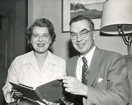
Martha & Kenneth Kidd (Photo credit: Jack Marshall)
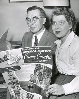
Martha & Kenneth Kidd (Photo credit: Jack Marshall)
Marketing your camp
Marketing your camp
Mark Robinson letter
Mark Robinson letter
Marjory Seeley-Rogers and Michael Treadwell recorded interviews
Marjory Seeley-Rogers and Michael Treadwell recorded interviews
Maritimes. 6 Nouvelle Ecosse et Nouveau Brunswick. Bruxelles, 1827. Phillips Atlases, 749. Vandermaelen, P.M.G. Amer. Sept. No. 44
Maritimes. 6 Nouvelle Ecosse et Nouveau Brunswick. Bruxelles, 1827. Phillips Atlases, 749. Vandermaelen, P.M.G. Amer. Sept. No. 44
Maritimes. 1851 Rapkin, J. Nova Scotia and Newfoundland. The illustrations by A. Russell & engraved by J. Rogers. The map drawn & engraved by J. Rapkin. London, J. Tallis, 1851. Coloured in outline. Coloured illustrations surrounding the map: Halifax, Nova Scotia and Cod fishing off Newfoundland. Has the seals of Nova Scotia and Cape Breton, and Newfoundland printed on the map. From: Tallis's Illustrated Atlas and Modern History of the World
Maritimes. 1851 Rapkin, J. Nova Scotia and Newfoundland. The illustrations by A. Russell & engraved by J. Rogers. The map drawn & engraved by J. Rapkin. London, J. Tallis, 1851. Coloured in outline. Coloured illustrations surrounding the map: Halifax, Nova Scotia and Cod fishing off Newfoundland. Has the seals of Nova Scotia and Cape Breton, and Newfoundland printed on the map. From: Tallis's Illustrated Atlas and Modern History of the World
Maritimes. 1846 Arrowsmith, John, 1790-1873 Lower Canada, New Brunswick, Nova Scotia, Prince Edwards Id., Newfoundland and a large portion of the United States. London, pubd. 15 Feby. 1846 by J.Arrowsmith, 10 Soho Square. Has inset map of Newfoundland. [Map no.] 42. From: The London Atlas of Universal Geography. Phillips, Maps, p. 197
Maritimes. 1846 Arrowsmith, John, 1790-1873 Lower Canada, New Brunswick, Nova Scotia, Prince Edwards Id., Newfoundland and a large portion of the United States. London, pubd. 15 Feby. 1846 by J.Arrowsmith, 10 Soho Square. Has inset map of Newfoundland. [Map no.] 42. From: The London Atlas of Universal Geography. Phillips, Maps, p. 197
Maritimes. 1747 Bowen, Emanuel, d. 1767 A new and accurate map of the islands of Newfoundland, Cap Breton, St. John, and Anticosta, together with the neighbouring countries of Nova Scotia, Canada, etc. drawn from the most approved modern maps and charts and regulated by Astronl. Observatns. by Eman. Bowen. London, 1747. Coloured in outline. 13.5 x 16.75 in. "No. 95" Phillips, Maps. p. 475. Slot 39.
Maritimes. 1747 Bowen, Emanuel, d. 1767 A new and accurate map of the islands of Newfoundland, Cap Breton, St. John, and Anticosta, together with the neighbouring countries of Nova Scotia, Canada, etc. drawn from the most approved modern maps and charts and regulated by Astronl. Observatns. by Eman. Bowen. London, 1747. Coloured in outline. 13.5 x 16.75 in. "No. 95" Phillips, Maps. p. 475. Slot 39.
Maritimes. 1716 Moll, Herman, d. 1732 Newfoundland, St. Laurence Bay, the Fishing Banks, Acadia, and a part of New Scotland. By H. Moll, Geographer. London, J. Nicholson, 1716. Coloured in outline. Phillips Maps no. 47
Maritimes. 1716 Moll, Herman, d. 1732 Newfoundland, St. Laurence Bay, the Fishing Banks, Acadia, and a part of New Scotland. By H. Moll, Geographer. London, J. Nicholson, 1716. Coloured in outline. Phillips Maps no. 47
Margaret Love Bird fonds
Margaret Love Bird fonds
Maple Mountain Ontario, topographical map
Maple Mountain Ontario, topographical map
Map: Sketch of Lake Superior shewing the Supposed Northern and Western Limits of this Province in that direction. Quebec, Crown Lands Department, 12 March 1853.... Certified a true copy.
Map: Sketch of Lake Superior shewing the Supposed Northern and Western Limits of this Province in that direction. Quebec, Crown Lands Department, 12 March 1853.... Certified a true copy.
Map: Quebec. Aboriginal Communities and Minerals and Metals activities
Map: Quebec. Aboriginal Communities and Minerals and Metals activities
Map: Prairie Provinces. Aboriginal Communities and Minerals and Metals activities
Map: Prairie Provinces. Aboriginal Communities and Minerals and Metals activities
Map: Ontario. Aboriginal Communities and Minerals and Metals activities
Map: Ontario. Aboriginal Communities and Minerals and Metals activities
Map on Mercator's Projection, of Part of the N.W. Territory; Illustrating the Proposed System of Public Surveys. [1869]. Burland, Lafricain & Co., Montreal. Plan published by the Dept. of the Interior
Map on Mercator's Projection, of Part of the N.W. Territory; Illustrating the Proposed System of Public Surveys. [1869]. Burland, Lafricain & Co., Montreal. Plan published by the Dept. of the Interior
Map of Manley's Landing, Catchacoma Lake, Ontario (and vicinity), by Martin & Lawrie, Hamilton, Ont., no scale, sheet size 23cm x 30cm.
Map of Manley's Landing, Catchacoma Lake, Ontario (and vicinity), by Martin & Lawrie, Hamilton, Ont., no scale, sheet size 23cm x 30cm.
Map: Northern Territories. Aboriginal Communities and Minerals and Metals activities
Map: Northern Territories. Aboriginal Communities and Minerals and Metals activities
Map: Lake Superior by Lieut. Henry Wr. Bayfield assisted by Mr. Philip Ed Collins Mid. Between the Years 1823 & 1825. Quebec, Crown Lands Department, 12th March 1853. Certified a true copy
Map: Lake Superior by Lieut. Henry Wr. Bayfield assisted by Mr. Philip Ed Collins Mid. Between the Years 1823 & 1825. Quebec, Crown Lands Department, 12th March 1853. Certified a true copy
Map: British Columbia. Aboriginal Communities and Minerals and Metals activities
Map: British Columbia. Aboriginal Communities and Minerals and Metals activities
Map: Atlantic Provinces. Aboriginal Communities and Minerals and Metals activities
Map: Atlantic Provinces. Aboriginal Communities and Minerals and Metals activities