Showing 811 results
Archival description
Quebec, transportation/travel map
Quebec, transportation/travel map
Ontario, conservation areas map
Ontario, conservation areas map
Lake Temagami Area, Ontario, topographical map
Lake Temagami Area, Ontario, topographical map
Ontario, provincial parks map
Ontario, provincial parks map
Atlantic Provinces, transportation/travel map
Atlantic Provinces, transportation/travel map
Ontario, mineral resources map
Ontario, mineral resources map
Northwest Territories, transportation/travel map
Northwest Territories, transportation/travel map
Campbellford Ontario, topographical map
Campbellford Ontario, topographical map
Rice Lake Ontario, topographical map
Rice Lake Ontario, topographical map
Burleigh Falls Ontario, topographical map
Burleigh Falls Ontario, topographical map
Trent Canal Ontario, marine map
Trent Canal Ontario, marine map
Canada, Neilson's Centennial map
Canada, Neilson's Centennial map
Otonabee River Ontario, flood risk map
Otonabee River Ontario, flood risk map
Hastings Ontario, transportation/travel map
Hastings Ontario, transportation/travel map
Haliburton/Muskoka Ontario, transportation/ travel map
Haliburton/Muskoka Ontario, transportation/ travel map
Trent University first student register
Trent University first student register
Report: Report of the Special Committee on the Magdalen Islands, and the Western Part of This Province above Lake Huron
Report: Report of the Special Committee on the Magdalen Islands, and the Western Part of This Province above Lake Huron
Map: Lake Superior by Lieut. Henry Wr. Bayfield assisted by Mr. Philip Ed Collins Mid. Between the Years 1823 & 1825. Quebec, Crown Lands Department, 12th March 1853. Certified a true copy
Map: Lake Superior by Lieut. Henry Wr. Bayfield assisted by Mr. Philip Ed Collins Mid. Between the Years 1823 & 1825. Quebec, Crown Lands Department, 12th March 1853. Certified a true copy
Map: Sketch of Lake Superior shewing the Supposed Northern and Western Limits of this Province in that direction. Quebec, Crown Lands Department, 12 March 1853.... Certified a true copy.
Map: Sketch of Lake Superior shewing the Supposed Northern and Western Limits of this Province in that direction. Quebec, Crown Lands Department, 12 March 1853.... Certified a true copy.
Article (photocopy): "The Great Lakes Surveys of Henry Bayfield / by Amber Clement (from Michigan History, January/February 2013)
Article (photocopy): "The Great Lakes Surveys of Henry Bayfield / by Amber Clement (from Michigan History, January/February 2013)
Mary Tuer Diary and Letter Transcriptions
Office Holders in the United Counties: Jail Surgeons, Coroners, Justices of the Peace, Members of the Executive Council, etc.
Index: United Counties of Northumberland and Durham: Case Records, 1914-1917
Index to the letters of Walter J Francis
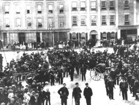
Peterborough Fire Brigade, n.d.