Showing 12035 results
Archival description
Hudson Bay. 1757 Bellin, Jacques Nicholas, 1703-1772 Carte de la Baye Hudson pour servira l'Histoire generale des voyages echelle de lieues communes de France par M. B.[ellin] Ingr. de la Marine, 1757. Coloured. 9 x 12 in. In upper left corner "Tome 14 in 4 No. 14"; in top right corner: "tome 14 in 8 Page 191". From: Charlevoix, Pierre Francois Xavier de, 1682-1761. Histoire et description generale de la Nouvelle France. Map no. ? See M. Bellin's introduction on maps in vol. III of Charlevoix
Hudson Bay. 1757 Bellin, Jacques Nicholas, 1703-1772 Carte de la Baye Hudson pour servira l'Histoire generale des voyages echelle de lieues communes de France par M. B.[ellin] Ingr. de la Marine, 1757. Coloured. 9 x 12 in. In upper left corner "Tome 14 in 4 No. 14"; in top right corner: "tome 14 in 8 Page 191". From: Charlevoix, Pierre Francois Xavier de, 1682-1761. Histoire et description generale de la Nouvelle France. Map no. ? See M. Bellin's introduction on maps in vol. III of Charlevoix
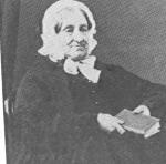
David Macmillan fonds
David Macmillan fonds
Cape Breton Island (N.S.) 16 Bellin, Jacques Nicolas, 1703-1772. Carte de l'Acadie Isle Royale, et pays voisins pour servir a l'Histoire generale des voyages, par M. B[ellin]. Paris, 1757. From: Charlevoix, Pierre Francois Xavier de, 1682-1761. Histoire et description generale de la Nouvelle France. Map no. ?. See M. Bellin's introduction on maps in vol. III of Charlevoix
Cape Breton Island (N.S.) 16 Bellin, Jacques Nicolas, 1703-1772. Carte de l'Acadie Isle Royale, et pays voisins pour servir a l'Histoire generale des voyages, par M. B[ellin]. Paris, 1757. From: Charlevoix, Pierre Francois Xavier de, 1682-1761. Histoire et description generale de la Nouvelle France. Map no. ?. See M. Bellin's introduction on maps in vol. III of Charlevoix
Frances Stewart fonds. 1978 additions
St. Lawrence, Gulf of. 15 Bellin, Jacques Nicolas, 1703-1772. Carte de Golphe de St. Laurent et pays voisins. Pour servir a l'Histoire generale des voyages. Paris, 1757. From: Charlevoix, Pierre Francois Xavier de, 1682-1761. Histoire et description generale de la Nouvelle France. Map no. ? See M. Bellin's introduction on maps in vol. III of Charlevoix
St. Lawrence, Gulf of. 15 Bellin, Jacques Nicolas, 1703-1772. Carte de Golphe de St. Laurent et pays voisins. Pour servir a l'Histoire generale des voyages. Paris, 1757. From: Charlevoix, Pierre Francois Xavier de, 1682-1761. Histoire et description generale de la Nouvelle France. Map no. ? See M. Bellin's introduction on maps in vol. III of Charlevoix
St. Lawrence, Gulf of. Bellin, Jacques Nicolas, 1703-1772. Carte du golphe de St. Laurent et pays voisins. Pour servir a l'Histoire generale des voyages. Paris, 1757? From: Charlevoix, Pierre Francois Xavier de, 1682-1761. Histoire et description generale de la Nouvelle France. Map no. ? See M. Bellin's introduction on maps in vol. III of Charlevoix
St. Lawrence, Gulf of. Bellin, Jacques Nicolas, 1703-1772. Carte du golphe de St. Laurent et pays voisins. Pour servir a l'Histoire generale des voyages. Paris, 1757? From: Charlevoix, Pierre Francois Xavier de, 1682-1761. Histoire et description generale de la Nouvelle France. Map no. ? See M. Bellin's introduction on maps in vol. III of Charlevoix
Louisbourg (N.S.). 1758 A map of the harbour of Louisburg and parts adjacent. [London, 1758]. Coloured in outline. 4.5 x 7 in. From: The London Magazine. Phillips Atlases, Maps p. 365
Louisbourg (N.S.). 1758 A map of the harbour of Louisburg and parts adjacent. [London, 1758]. Coloured in outline. 4.5 x 7 in. From: The London Magazine. Phillips Atlases, Maps p. 365
Louisbourg (N.S.). 1758 Jefferys, Thomas, d. 1771 [Two maps of Louisbourg: the first:] A Plan of the city and fortifications of Louisburg from a survey made by Richard Gridley, Lieut. Coll. of the Train of Artillery in 1745. "This important Frenc fortress was taken on the 17th of June 1745 after a siege of 49 days by nine Regiments (that were raised & equiped in 50 days in New England) and commanded by Sr. Willm. Pepperill, assisted by a Fleet under the command of Commodore Warren, with the loss of 101 men killed and 30 that died by sickness. This place was afterwards restored to the French by the Treaty of Aix la Chapel." by Thomas Jefferys, Geographer to the Prince of Wales at Charing Cross, Oct. 9, 1758. [The second:] A plan of the city and harbour of Louisburg, with the French batteries that defended it and those of the English, shewing that part of Gabarus Bay in which they landed, and the ground on which they encamped during the Siege in 1758. This second map has an inset map: A map of Gabarus Bay adjoi
Louisbourg (N.S.). 1758 Jefferys, Thomas, d. 1771 [Two maps of Louisbourg: the first:] A Plan of the city and fortifications of Louisburg from a survey made by Richard Gridley, Lieut. Coll. of the Train of Artillery in 1745. "This important Frenc fortress was taken on the 17th of June 1745 after a siege of 49 days by nine Regiments (that were raised & equiped in 50 days in New England) and commanded by Sr. Willm. Pepperill, assisted by a Fleet under the command of Commodore Warren, with the loss of 101 men killed and 30 that died by sickness. This place was afterwards restored to the French by the Treaty of Aix la Chapel." by Thomas Jefferys, Geographer to the Prince of Wales at Charing Cross, Oct. 9, 1758. [The second:] A plan of the city and harbour of Louisburg, with the French batteries that defended it and those of the English, shewing that part of Gabarus Bay in which they landed, and the ground on which they encamped during the Siege in 1758. This second map has an inset map: A map of Gabarus Bay adjoi
Montreal (Que.). Jefferys, Thomas, d. 1771 Plan of the town and fortifications of Montreal or Ville Marie in Canada. Published by Thos. Jefferys Geographer to His Royal Highness the Prince of Wales, at Charing Cross, Jan. 30, 1758
Montreal (Que.). Jefferys, Thomas, d. 1771 Plan of the town and fortifications of Montreal or Ville Marie in Canada. Published by Thos. Jefferys Geographer to His Royal Highness the Prince of Wales, at Charing Cross, Jan. 30, 1758
Quebec (Que.). [Oakley, Edward, 18th century] A plan of Quebec: Metropolis of Canada in North America. [London, 1759]. From: The London Magazine, 1759. Originally published: London, by E. Oakley and sold by J. Rocque near Round Court in the Strand, 1759. Phillips Atlases, Maps p. 733
Quebec (Que.). [Oakley, Edward, 18th century] A plan of Quebec: Metropolis of Canada in North America. [London, 1759]. From: The London Magazine, 1759. Originally published: London, by E. Oakley and sold by J. Rocque near Round Court in the Strand, 1759. Phillips Atlases, Maps p. 733
Quebec (Que.). 1760 Jefferys, Thomas, d. 1771 An authentic plan of the River St. Laurence from Sillery, to the Fall of Montmorenci, with the operations of the Siege of Quebec under the Command of Vice-Adml. Saunders & Major Genl. Wolfe down to the 5. Sepr. 1759. Drawn by a Captain in His Majesties Navy. [London?] 1760. "This map is dedicated to the Right Honourable William Pitt Esqr...." Includes two inset maps: Part of the Upper River of St. Laurence, and A View of the action gained by the English Sepr. 13 1759 near Quebec brought from thence by an Officer of Distinction
Quebec (Que.). 1760 Jefferys, Thomas, d. 1771 An authentic plan of the River St. Laurence from Sillery, to the Fall of Montmorenci, with the operations of the Siege of Quebec under the Command of Vice-Adml. Saunders & Major Genl. Wolfe down to the 5. Sepr. 1759. Drawn by a Captain in His Majesties Navy. [London?] 1760. "This map is dedicated to the Right Honourable William Pitt Esqr...." Includes two inset maps: Part of the Upper River of St. Laurence, and A View of the action gained by the English Sepr. 13 1759 near Quebec brought from thence by an Officer of Distinction
Quebec (Que.). 1760 Jefferys, Thomas, d. 1771 A plan of the City of Quebec, the capital of Canada, as it surrender'd 18th September, 1759 to the British fleet and army, Commanded by Vice-Adml. Saunders, & Brigadr. Gen. Townshend. Published according to the Act of Parliament, January 15, 1760 by Thos. Jefferys at Charing Cross. [London, 1760]
Quebec (Que.). 1760 Jefferys, Thomas, d. 1771 A plan of the City of Quebec, the capital of Canada, as it surrender'd 18th September, 1759 to the British fleet and army, Commanded by Vice-Adml. Saunders, & Brigadr. Gen. Townshend. Published according to the Act of Parliament, January 15, 1760 by Thos. Jefferys at Charing Cross. [London, 1760]
Mackinac, Straits of (Mich.). 1761 A plan of the Straits of St. Mary and Michilimakinac to shew the situation & importance of the two westernmost settlements of Canada for the fur trade. London, 1761. Coloured. The earliest separate map of the Sault Ste. Marie area. From: Gentlemen's Magazine, 1761
Mackinac, Straits of (Mich.). 1761 A plan of the Straits of St. Mary and Michilimakinac to shew the situation & importance of the two westernmost settlements of Canada for the fur trade. London, 1761. Coloured. The earliest separate map of the Sault Ste. Marie area. From: Gentlemen's Magazine, 1761
Canada. 5 Seale, Richard William. An accurate map of Canada, with the adjacent countries; exhibiting the late seat of war between the English & French in those parts. London, 1761. Coloured. Mounted on linen. From: The Universal Magazine, 1761. Phillips, Maps. p. 191
Canada. 5 Seale, Richard William. An accurate map of Canada, with the adjacent countries; exhibiting the late seat of war between the English & French in those parts. London, 1761. Coloured. Mounted on linen. From: The Universal Magazine, 1761. Phillips, Maps. p. 191
Quebec (Que). Smyth, Henry. ["Quebec. A view of Quebec from the Bason"] from a drawing by Henry Smyth. London, John Bowles. See p. 12 Divolpi
Quebec (Que). Smyth, Henry. ["Quebec. A view of Quebec from the Bason"] from a drawing by Henry Smyth. London, John Bowles. See p. 12 Divolpi
Newfoundland. Kitchin, Thomas, d. 1784. A new map of the only useful and frequented part of New Found Land. London. From: The London Magazine v. 31, p. 408
Newfoundland. Kitchin, Thomas, d. 1784. A new map of the only useful and frequented part of New Found Land. London. From: The London Magazine v. 31, p. 408
Quebec. Kitchin, Thomas, d. 1784. A new map of the Province of Quebec in North America. [London?]
Quebec. Kitchin, Thomas, d. 1784. A new map of the Province of Quebec in North America. [London?]
Nova Scotia. 27 A map of the South Part of Nova Scotia and its Fishing Banks with two inserts: A Plan of Halifax Survey'd by M(oses) Harris, and, A View of Halifax drawn from ye top mast head. From: The English Pilot, the fourth book, describing the West-India Navigation, from Hudson's Bay to the river Amazones... Map no. 14. Dublin, 1767. Map also has cartouche: To the right Honble the Lords Comission for Trade and plantations. No author given. Phillips notes the map was probably inserted. Appears to be based on Thomas Jefferys' map of 1750
Nova Scotia. 27 A map of the South Part of Nova Scotia and its Fishing Banks with two inserts: A Plan of Halifax Survey'd by M(oses) Harris, and, A View of Halifax drawn from ye top mast head. From: The English Pilot, the fourth book, describing the West-India Navigation, from Hudson's Bay to the river Amazones... Map no. 14. Dublin, 1767. Map also has cartouche: To the right Honble the Lords Comission for Trade and plantations. No author given. Phillips notes the map was probably inserted. Appears to be based on Thomas Jefferys' map of 1750
Wallis family fonds
Wallis family fonds
An Act of George III to help defray charges of civil government in the Province of Quebec
An Act of George III to help defray charges of civil government in the Province of Quebec
Northwest Coast of North America and Russia, Northeastern. Imperatorsk i a adademiia nauk (Russia) Russian discoveries from the map published by the Imperial Academy of St. Petersburg. Printed for Robert Sayer, London. published March 27, 1775
Northwest Coast of North America and Russia, Northeastern. Imperatorsk i a adademiia nauk (Russia) Russian discoveries from the map published by the Imperial Academy of St. Petersburg. Printed for Robert Sayer, London. published March 27, 1775
Alan Brunger fonds. 2021 additions
Alan Brunger fonds. 2021 additions
Prince Edward Island. 26 Holland, Samuel, 1728-1801. A map of the Island of St. John, in the Gulf of St. Lawrence divided into counties and parishes and the lots as granted by Government to which are added the soundings round the coast & harbours improved from the late survey of Captain Holland. [London, Sayer & Bennett, 6 April, 1775] From: The North American Pilot for Newfoundland, Labradore, the Gulf and River St. Laurence. Chart XIII
Prince Edward Island. 26 Holland, Samuel, 1728-1801. A map of the Island of St. John, in the Gulf of St. Lawrence divided into counties and parishes and the lots as granted by Government to which are added the soundings round the coast & harbours improved from the late survey of Captain Holland. [London, Sayer & Bennett, 6 April, 1775] From: The North American Pilot for Newfoundland, Labradore, the Gulf and River St. Laurence. Chart XIII
St. Lawrence River. 25 Jefferys, Thomas, d. 1771 An exact chart of the River St. Laurence from Fort Frontenac to the Island of Anticosti showing the soundings rocks, shoals, etc. with views of the lands and all necessary instructions for navigating that river to Quebec. London, Robert Sayer, May 25, 1775. Originally published: Lond, Thomas Jefferys at Charing Cross, Jan. 25, 1757. Phillips maps p. 762. Phillips Atlases 1165, map no. 9
St. Lawrence River. 25 Jefferys, Thomas, d. 1771 An exact chart of the River St. Laurence from Fort Frontenac to the Island of Anticosti showing the soundings rocks, shoals, etc. with views of the lands and all necessary instructions for navigating that river to Quebec. London, Robert Sayer, May 25, 1775. Originally published: Lond, Thomas Jefferys at Charing Cross, Jan. 25, 1757. Phillips maps p. 762. Phillips Atlases 1165, map no. 9
Robert Lloyd Hunter collection. 1999 additions
Robert Lloyd Hunter collection. 1999 additions